

Do you need a land survey in salem but feel that it’s more costly than you had expected? The great news is that always there are some ways to scale back the cost of land surveys.
The cost of your land survey depends on many factors such as the size of the land, type of terrain, type of survey, equipment required, project timing, availability of existing records, and access to the property. Due to these variables, it’s often difficult to work out a flat rate for the land survey. Most commonly a land surveyor can provide an estimate of final cost based on their general experience.
Compare to the development cost; the land survey cost is often meager; at the same time, it remains an important data set for architects and engineers. For this reason, it’s normal for clients to take a low risk to approach a trusted land surveyor to conduct a land survey for their project. Doing a land survey earlier allows greater flexibility in finding the problems at the design stage of the project. But for those looking to control the budget, the land survey is, of course, another area that can come under scrutiny.
We’re here to recommend a list of 11 guidelines on how you can both cut the cost of your land survey and maximize the value received from the land surveyor you select
1. Explain the purpose of the survey explicitly
It always helps your Surveyor to understand why you need a survey for your land. If you don’t tell, your Surveyor, why you need a land survey, they may give you a quote for more than you need.
Land Survey data will be utilized in different disciplines like in the planning permission (local body / DTCP Approval), architecture designing, Construction engineering sectors, and many. If you’re a professional and know how to use the land survey data on different disciplines, that’s great. If you do not have this knowledge as well and need the advice to create a specification, please inform your land surveyor what it is you are planning to do. And also you should consult your planning professionals, architects, or engineers for those who are going to utilize this data.
2. Provide necessary documents to your Surveyor before the survey starts
Before starting the land survey, your surveyor needs a copy of your deed and the most recent documents like FMB / TSLR / Layout Sketch, Patta available for your property. This is how they will know which boundary stones to look for and what the type of survey will need. Giving a copy of your deed should be easy because you should own a copy. However, to look for documents like FMB / TSLR Sketch, you may have to go to your local VAO or Revenue Department and request a copy of any Document for your property. Hand over these documents to your Surveyor saves them the time of looking them up and, in return, saves you money.
3. Only Acquire the Type of Survey You Need
There are different types of land surveys, such as a boundary survey, Topographic Survey, As-Built Survey, Setting-Out Survey, Leveling Survey, Document Verification Survey, Drone Mapping, etc. Each survey gives different amounts of details. A full Topographic Survey is the most detailed but is often unnecessary for most homeowners. Some surveys need more detailed work than others and therefore tended to cost more. For example, the cost of a land survey for a fence will likely be less than a full topographic survey of the same piece of land. Knowing accurately, what type of survey you need for your current requirements allows you to order the lowest cost survey.
4. Clear the site and provide open free access for faster survey
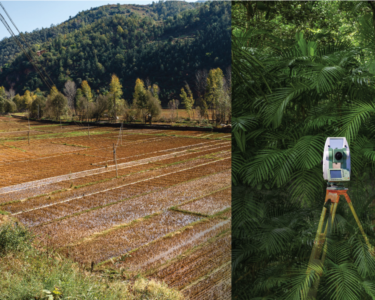
When a land surveyor surveys a site that is muddy, densely vegetated, or otherwise concealed, he may leave areas un-surveyed due to insufficient access or visibility. Because of that, both the quantity and quality of survey data is likely to suffer. For a surveyor, it’s tough to navigate into your field if bushes cover it or if you’ve got things near the boundary line that the Surveyor has to go around or move to finish their survey, this might slow their work. An unkempt property can hamper survey progress considerably. Trim bushes and cut any overgrown grass before your Surveyor arrives. Additionally, clear your yard and put away any things that are not permanently placed to make for the simplest, fastest survey possible. If your property is well maintained, clear of obstructions, and easy to access, the survey work will be quicker and cheaper.
5. Remove unwanted area from the survey
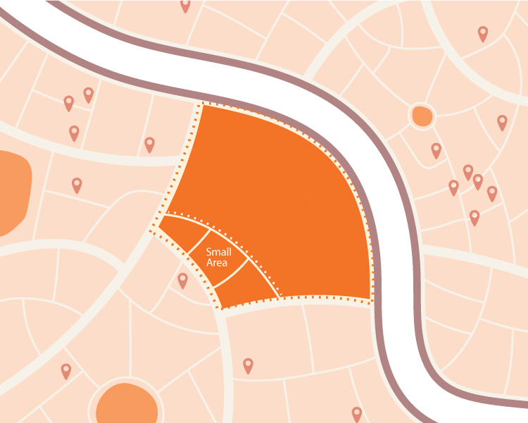
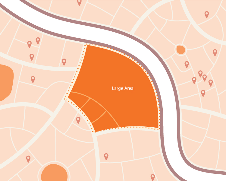
Just because you are having or buying a parcel of land, doesn’t mean you are planning to develop all of it at once. Work out which portions of the land you are going to utilize or develop ask for a quote for this area only, rather than the full title. A large portion of land is likely going to cost more money than a smaller portion. Surveys of a small portion of land can only take a day to complete; more complicated projects could take several weeks or more.
6. Remove unnecessary detail from less essential areas
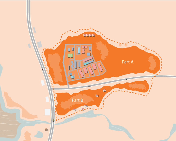
A standard topographic survey specification will include all-natural and manmade features. The cost of the survey will increase with the level of details surveyed. If it is possible, split the parcel where less detailed information is required: –
Splitting part example
Part A: – Development area – full topographic detailing
Part B: – Flood Plain – Spot levels only
Trees have the potential to slow down a topographic land survey. If you don’t need the location of trees for your project, inform the Surveyor – that will considerably save time.
It’s really great to have a wealth of data; unfortunately; it is not always cost-effective. Remove a list of features that are irrelevant to your purpose. This will reduce the cost of the land survey.
7. Discuss with Your Neighbors Ahead of Time about the survey
All the properties share common boundaries with immediate neighbors. A land survey is usually used to make sure the boundaries between you and your neighbor is correct. If your neighbors see a strange person on or near their land, they may want to know what they’re doing there. If your Surveyor has got to stop to answer questions or calm down an angry neighbor, this might extend the amount of time needed to finish the survey. To prevent this, talk with all of your neighbors and let them know when you plan to have the survey conducted. If your neighbors are also interested in getting their boundaries marked, ask them to share for the survey and save the cost.
8. Engage a renowned surveyor
The old maxim “Do it right or do it twice” relevant to a land survey. It doesn’t matter how cheaply you acquire a land survey if it’s not fit for purpose. Other professions, whose work depends on it, will demand that the survey is re-commissioned.
Tips to Hire a Professional
Compare Your Bids Get a few bids from different companies and go over them line by line. Be wary about the cheapest offers, as these may not include some items (such as end-to-end data analysis) that are needed for a successful land survey.
1. Ask for sample drawings. If you’re not the end-user, check with whoever is that the sample drawing covers all their standard needs.
- Check the team strength. A company with a larger Survey team usually can complete a survey quicker.
- Check credentials. Make sure they work on your project – the more complex your project, then you need more skilled the Surveyor.
- Look Up Online Reviews, and ask for references: The cheapest pro isn’t always the right one.
Are you looking for Professional Land Surveyors? We can help. At RVS Land Surveyors, we have an extraordinarily diverse array of land survey technologies, as well as experience to match. Contact us today to find out more.
9. Consider Project delivery time – the time is money
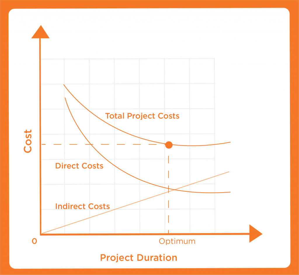
Project delivery time can be a critical factor in determining if a land survey quote offers value for money. If you’re in no particular rush, make this clear to your land surveyor. Prices are likely to be economical when not subjected to intense time pressures, which can result in late working and staff overtime costs.
10. Perform Your Own Survey
Many survey stones are buried or difficult to find. Suppose you feel confident with your boundary survey stones. In that case, you can complete your own amateur survey and potentially reveal some hidden stones ahead of time, making your professional Surveyor’s job easier. The professional Surveyor will confirm the location of your boundary stones as per the revenue record. Keep in mind that only a Government surveyor can move boundary Stones. When you reveal survey stones, you must leave them where they are, even if you think it is not in the right place.
11. Hire the Technologies to reduce land survey costs
When it comes to major development projects, we face a lot of difficulties in the field. That kind of project must meet the same standards for quality and safety that every other project is held to, but at the same time, it has to be in the budget.
One way to cut costs of projects without negatively affect results is by engaging new technologies. Particularly, new land surveying technologies such as lidar and drones can make it significantly less expensive to gather needed data, allowing saving money before the project even breaks ground. For example, unmanned aerial vehicles (UAVs), also known as drones, can survey as much as 400 acres in a single hour than the traditional land surveying methods. This helps engineers make better use of their valuable time by cutting down the waiting time to get the data they require to accomplish their jobs.

————————————Thanks to RVS Survey——————————————–