

Topographic Survey
Precise to detailed surface mapping! Scope of Topographic Mapping is exhaustive on site conditions from urban and regional planning, project design, road and utilities route design, site preparation and grading, to quantity and volume calculation. Topographic mapping can be executed with both conventional satellite-based positioning system and the traditional method of total station system to cross-check the accuracy of the professional standards. We use drone based topographic mapping survey on a larger extent to analyze the survey workings with accurate measurements for effective decision-making strategy. Accuracy and timely delivery are the key essential for topographic mapping services.

BOUNDARY SURVEY
Earmark your right piece of land! Boundaries are the actual markings on land as per legal documents and records. The boundary survey will help out to ensure/rectify the correct boundary line marking on the land extent or to set up a new boundary line. Boundary survey is carried out in construction for building corner markings, boundary mapping records, subdividing the lands as per rules and regulations, resolution on encroachment conflicts, and governmental surveys on new project implementation. A key decision maker on conflicts!

AS-BUILT SURVEY
Gains of plan vs actual! Major development works in all sectors of projects have pitfall in the planning and execution. Filing or bridging the gap between the plan and actual is a tough and major task in the large scale projects. The As-Built survey of The Salem Surveyors helps to scale up the difference and keep an eye on the as-built conditions. The As-built surveys have a huge scope of work on the planning and construction team to meet out the deviations and elevations mismatch. This survey also plays a vital role in interior planning and designing works. As-Build Survey the actual forerunner of budgets!
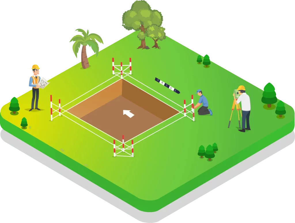
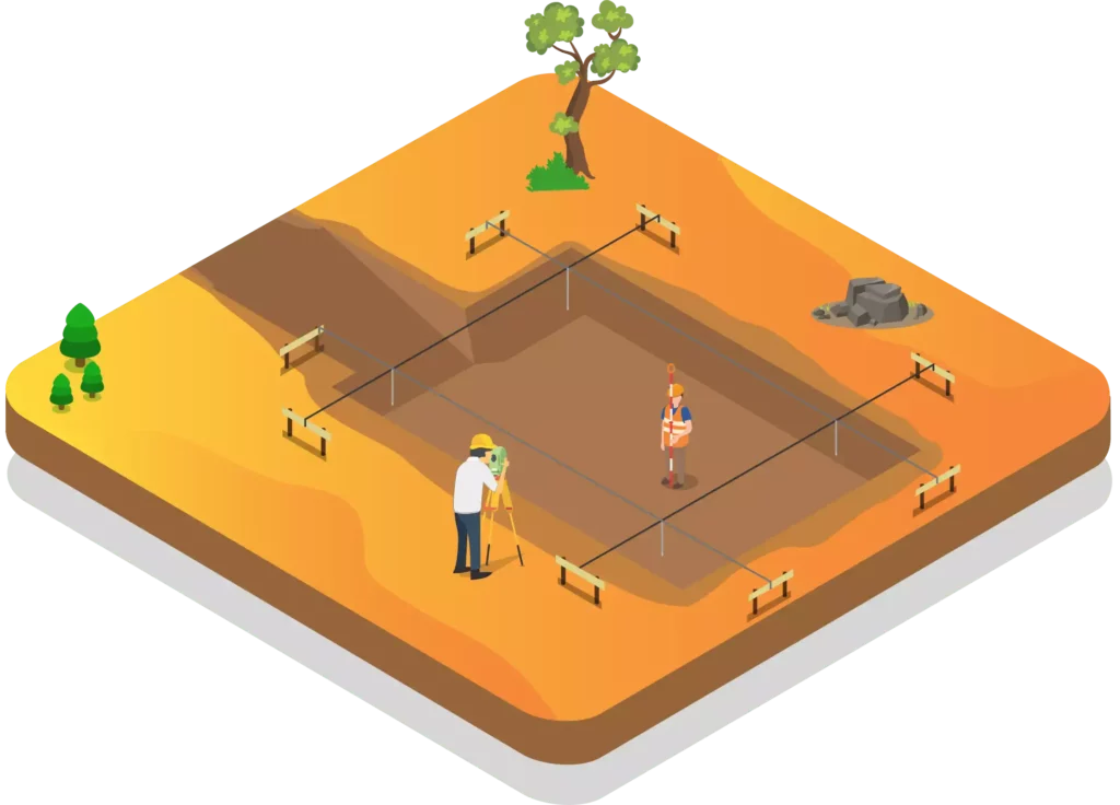
SETTING-OUT SURVEY
Careful position marking of nooks! Setting out surveys carried out to mark the exact position in the project field including the elevation of construction elements like footing, column, center line, building boundaries, angles and joints of steel structures. In simple, the position marking of starting points and boundaries as per the design plan of architects. The Salem Surveyor expert team ensures that the marking on setting-out surveys is executed with much care and effort for the reliable perfect works. The perfectionist approach!

MASTER PLANNING SUPPORT SURVEY
Static master data! Master plans for any city, project or commercials are to be derived on an analyzing the geographical, topographical, terrain, flood, celestial, transport routes, boundary, and non-spatial data. The Salem Land Surveyors render a cost-effective solution for analyzing the various mapping data and suggests the best options for master planning that lead to a fool-proof system. The credential master planner!
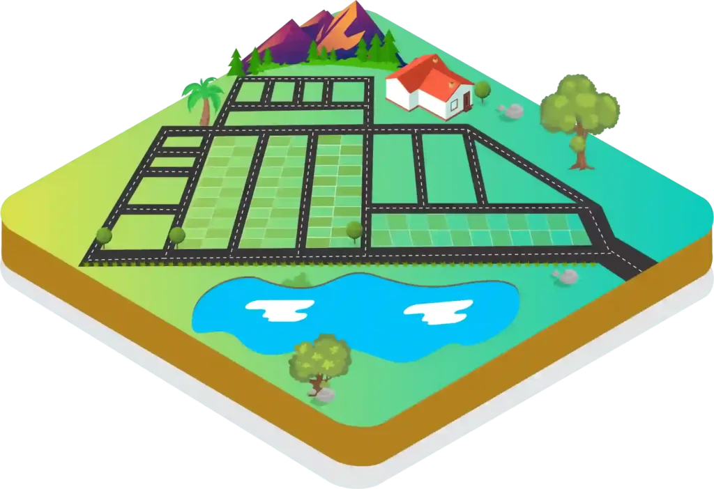
SUBDIVISION AND LAYOUT DESIGN SURVEY
Ease out your property stress! It is been customary to hold up with the selling out or dispersing of huge property area. The Salem Land Surveyors help out to subdivide and form layouts without any loss on the property valuations. We focus on analyzing the surface area of any land with the perspective of gaining profit without any loss or damage to the existing and the neighboring property extents. Subdividing and layout of the huge family property extent can be sorted out at ease with the proper planning and design implementations. Maximize the profit avenues with proper planning!

DOCUMENTS VERIFICATION SURVEY
Nightmare on land purchases! People tend to invest their hard earned money in increasing their purchasing power on property. The nightmare on property purchase is the mismatch in land extent on the records or deeds and the actual field area. The Salem Land Surveyors help the property owners to identify the actual field area. We analyze and calculate the exact measuring on land and the diversions in the records can be altered to increase the credibility on the value for money invested. The nightmares are ignored and happy faces of gestures between the parties been rejuvenated. Our accurate detailed predictions have resolved many land disputes and clutches. Convert your nightmares into dreams!

ALIGNMENT PLANNING SURVEY
Alter to the perfect point! Any sectors have the problem of aligning to design. The Salem Land Surveyors help out to ease your critical problem of alignments encountered in the developmental projects like roads, pipelines, power transmission lines, tower alignment including the incorporation of machining tools and equipment. The perfect alignment yields a greater output with minimal costing. The Salem Surveyor performs the alignment planning survey with total stations and precise leveling instruments for the successful planning and perfect implementation of any projects. Accountable solution partner!
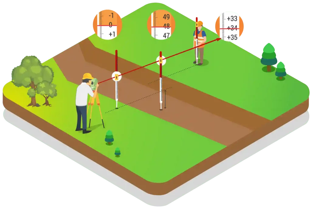
LEVELING SURVEY
Zeroing the perfect elevation! The extent of land verticals differ in size and shape with ups and downs. Clearing the construction site with ground leveling is a bit major task considering the geographical and terrain regions substantiating the prescribed constructions. The Salem Surveyor help to successfully complete the projects on the terrain regions like water flow, road works on bitumen laying, construction works from foundations to installation of major plants and machinery. The expertise team with the use of digital leveling, optical leveling, latest technology, and satellite equipment yields the perfect leveling of project works with respect to benchmark positions. Time-bound accurate leveling!

DRONE MAPPING
Drones are the perfect solutions for aerial mapping. With a drone, It is possible to carry out topographic surveys with highly accurate measurements and faster than traditional land surveying methods. Drone mapping is even widely helpful in complex or difficult to access environments where human movement is a great challenge. With the combination of drones and high-resolution cameras enables the mapping industry at levels of details never before imagined. The Salem Land Surveyors is the first land surveying company implements drone mapping in salem. Get unimaginable topographic data with unbelievable accuracy.
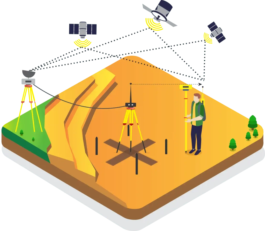
CONTROL NETWORK ESTABLISHMENT
Key to success! The control network establishment survey is a tedious and important process to identify the benchmark position of any particular region or project extents. The Salem Land Surveyors with the help of DGPS instruments (Differential Global Positioning System) and technology identifies the key referential benchmark point with data accuracy. The benchmark is the common trustworthy coordinate point important for any project success from the project planning, design, construction, to documentation phases. As the accuracy in bench marking the project coordinate is the key success to any project, we suggest our clients identify the project coordinate before project commencement to minimize the cost of reworks. Accurate in the benchmark positioning!
EARTH WORK VOLUME CALCULATION
The hardship of volumes! Earthwork is a tremendous job that involves huge manpower, planning and public support. Earthworks include road works, highways, irrigation like canals, dams, land grading, etc. Biding of earthwork contracts revolves around the accurate data information on the land extent, usage, and planning extent that lead to substantial overhead costing. The Salem Land Surveyors help them to scale up the surface area to any stretchable extent using total station, auto levels or Real Time Kinematic (RTK) system to drone according to the specification/need and provide accurate information with details. Helpline for tough times on volumes!

Road Survey

Levelling Survey
Know More

Layout design & Marketing Works

Building Survey
Know More

Pipeline & Structural Steel Survey

Boundary Survey
Know More